Of Washington, I will say only this: 46 degree Celsius weather is no joke. Don't visit in July.
The Trip
The trip ended up being 414 km with around 17,000 feet of vertical. Compared to my Jasper-Banff trip in 2013, this was going to be a much more demanding trip. After the heat of Washington, we were basically:
via GIPHY
Stupid creatures that we are, we had already told people we were going to do this trip. We were honour-bound to at least give it a shot.
Day 0: Amtrak from WAS to CVS
After a long struggle, Amtrak is embracing cyclists! No more dismantling your bike and boxing it for transport -- just reserve a seat and roll on!
In theory. In practice, Amtrak's brain-dead boarding policy in WAS requires a last-minute rush to navigate your bike and your gear down to the train platform. Once there, you will ask the Amtrak agents what to do. They will direct you to the baggage car. A gentleman there will say "No, no, no -- who told you that you could bring your bike like that?" And in the five minutes before the train leaves, you will get to persuade him that: (a) Amtrak's website, (b) Amtrak's press releases, (c) Amtrak's Guest Services attendant in the station and (d) your extra-expensive ticket told you that. He'll grudgingly toss your bikes into the car and you'll wonder if your bikes are going to make it in one piece or not. (See also: I've made a huge mistake.)
Your train will arrive late, naturally.
And if it rains, the train car will leak a steady amount of water onto you from random locations in the roof. Having waterproof bike gear will prove handy to fashion makeshift umbrellas.
Amtrak: essentially terrible.
Day 1: Bumming around Charlottesville and biking to Misty Mountain Campground
 |
| The marquee at Charlotteville's Paramount Theater |
After sorting that out, we had some time to kill: craft beers at Citizen Burger? Yes, please! We hit up the library for some A/C and battery charging then caught the soundcheck of their free Fridays After Five program before hitting the road.
Ivy Road, the road to Misty Mountain, is pretty rough. Narrow shoulders, plenty of traffic. There's a short respite where you can bypass it on route 738 which is fantastic: empty country road with plenty of shade trees.
Right before arriving at Misty Mountain, we passed a beer store, a grocery store and a restaurant. Damn it, we should have brought fewer freeze-dried meals! Misty Mountain's tent sites are way up and way back from the rest of the sites...which made for excellent star-gazing.
Day 2: To Montebello Campground, a.k.a. wtf are we doing
We were initially headed to Sherando Lake Campground, but they booked up and we couldn't sweet talk them into letting us stay anyway. We chose Montebello as an alternate and didn't put much thought into our route. Every mountain road is the same, right?
After 10 miles or so, we paused for elevensies.
 |
| Nutella makes everyone smile. |
 |
| The "this" we'd prefer it to stay like. |
We got to the top. "At least that's over. And going down will be fun!"
The down portion: a dirt road with loose-packed gravel, same steepness. Not fun.
We got to the bottom. "At least that's over! Man, we sure made a mistake going on that road. It'll get better."
Starting at Nash, there's a 4.4% grade for 3.9 km. Followed immediately by a 7.2% grade for 4.0 km.
We arrived at Montebello. We didn't say anything, because by this point we weren't on speaking terms.
After mutely checking in to the campground, the clerk noted: "What you're doing out there", she gestured towards the bikes, "that doesn't seem like much fun." I steamed a little. Not at her comment, really; more a natural result of being hot and sweaty.
Day 3: More Montebello
Luckily, we had planned to spend an extra day at whatever campground we were at, since we knew the first day would be brutal. We had ambitious plans of maybe doing a hike--maybe to Crabtree Falls?
But since we now had first-hand knowledge of the road to Crabtree Falls, we nixed that plan. Instead, we hung out, barbecued and went for a short walk. It was glorious.
Day 4: To Waynesboro
Time for us to get out of the state forest and start making our way towards Shenandoah National Park, with a pit stop in Waynesboro.
Which meant doing a 9 km descent. That was fun. The terminal velocity of my loaded touring bike appears to be about 55 km/h, at which point wind resistance prevents further acceleration.
And then, since we hadn't learned our lesson yet, we took Route 814 to the Blue Ridge Parkway, a 7.0% grade for 7.3 km. Oops. This was actually not that bad. There were lots of switchbacks ensuring that the grade was very even, so the going was slow but steady. You'd occasionally get a peek between the trees to a gorgeous view, too.
I should mention that this trip started as a simple idea: Cycle part of the iconic, 755 km Blue Ridge Parkway. As plans firmed up, things changed. Behold, the entirety of the Blue Ridge that we cycled:
 |
| About 100m - from the road on the left to the sign on the right. |
We arrived at Waynesboro in plenty of time to do some breakfast shopping for the rest of the trip. This Wal-Mart was chock-full of people of Wal-Mart. But they had Wasa crackers, so they get a pass!
 |
| They also had beer. |
Day 5: To Loft Mountain Campground
We jumped on Route 250 (yuck, 60 mph speed limit, but mostly 2 lanes in the direction we were going) and arrived at Rockfish Gap, the southern entrance to Shenandoah National Park in no time:
 |
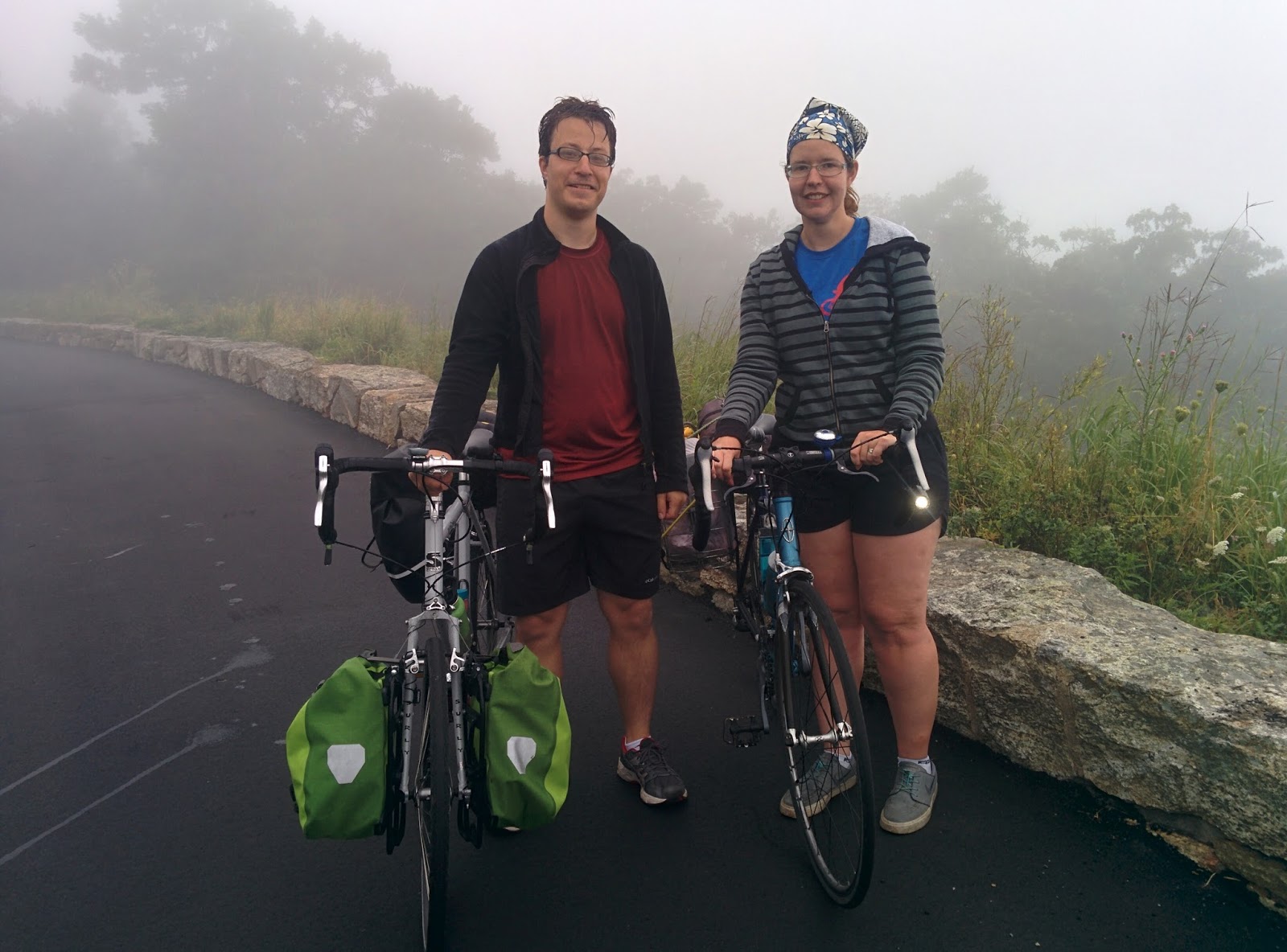
| One of three selfies we took. |
Shortly after entering the park, we were passed by a day cyclist on a road bike. He asked if we had ever been to Shenandoah. We called back that we hadn't. He shouted "Here's-what-you-need-to-know: this-hill-goes-on-for-about-3-mies-then-it's-pretty-good-then-there's-a-really-brutal-2-mile-hill-leading-to-Loft-Mountain." We bellowed our appreciation.
 |
| Our Loft Mountain campsite. |
Loft Mountain had great walk-up tent sites away and down from the ring road through the campsite. You had a real feeling of isolation and being in nature. Which was great, until you looked up from the dinner you were preparing and saw a black bear ambling through the brush 30 feet from you towards the Appalachian Trail. This was a real shame: that short stretch of the AT went from our campsite to the camp store which sold, among other things, alcoholic beverages. I would have loved to be able to say I hiked the Appalachian Trail to a beer store.
As we settled in for the night, our next door neighbour busted out her banjolele and serenaded us to sleep with Paul Simon's back catalog. Great day.
Day 6: To Big Meadows Campground
It was rainy and foggy when we broke camp for breakfast. A fellow struck up a conversation with us and asked if we were hiking. When we explained that we were bicycling, he blessed us with the sign of the cross and backed away slowly. Hmm.
The day did eventually clear up, but not until after we enjoyed lunch in this ethereal setting at the South River picnic area:
 |
| The mists during lunch at South River picnic area. |
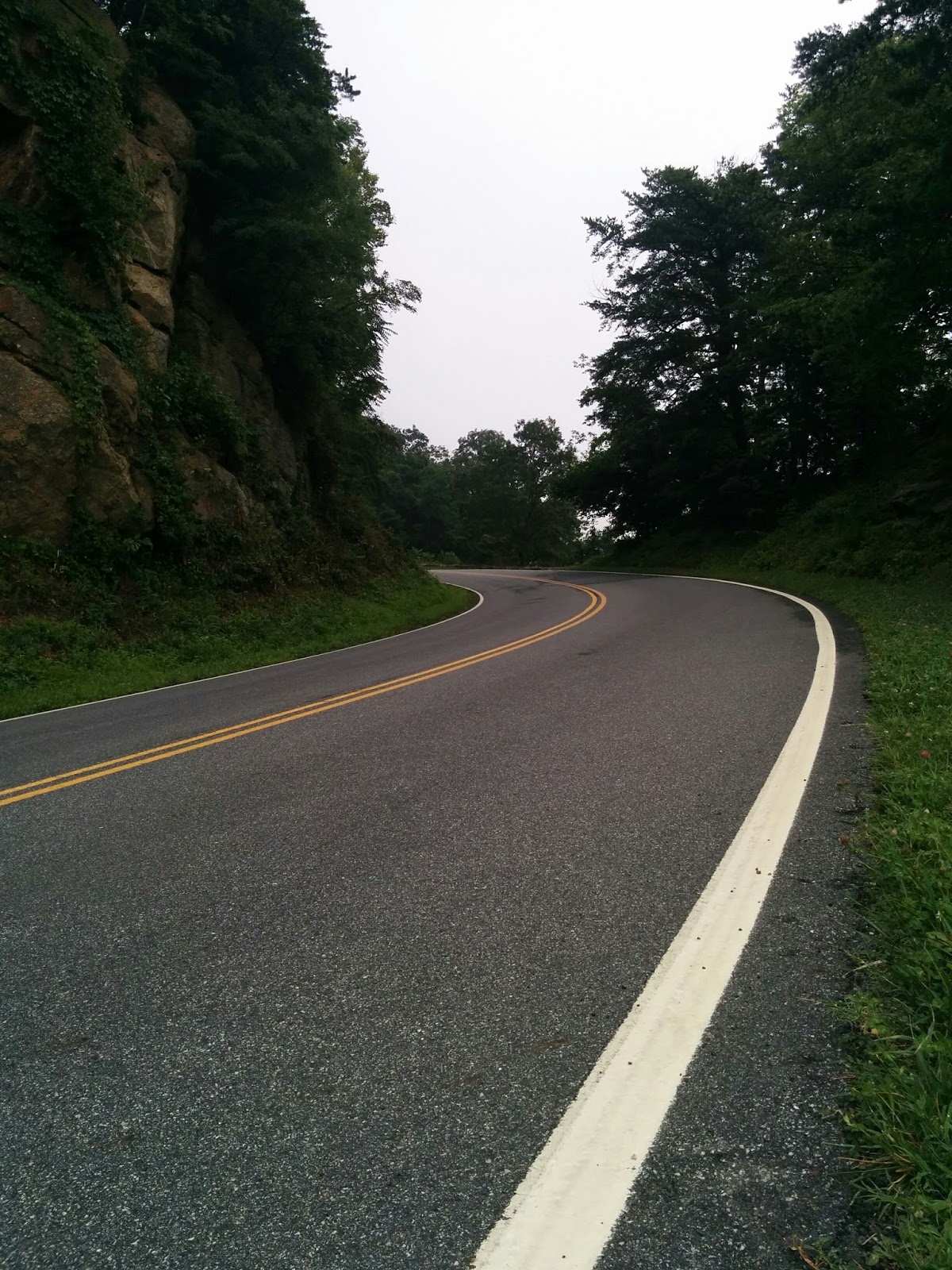 |
| A twisty section of Skyline Driver. |
Some of the viewpoints had informational kiosks, like this one:
 |
| "tapped to help" is a funny thing to say. |
It was manifestly hopeless to undertake to acquire the necessary area by direct purchase [because] any of the thousands of owners or claimants could hold up the entire project unless paid exorbitant and unfair prices, with jury trials, appeals, and all the endless delays which can be injected into ordinary condemnation proceedings by selfish, stubborn, and avaricious litigants.
William E. CarsonDirector of Virginia Conservation and Development Commission
The consortium did an admirable PR job. Newspapers faithfully painted the current occupants as hillbillies and criminal Prohibition-era moonshiners who would do well to be relocated. This culminated in a sociologist publishing the 1933 book Hollow Folk purporting, amongst other things, that the children growing up in the mountains did not have toys and indeed, did not even know the word toy.
An archaelogical dig on the site of a building dismantled by the Civilian Conservation Corps would later show that mountain residents did actually have such amusements as toys from mail-order catalogs and musical records, but that would be too late. The state passed a law to first condemn all property in the park and then purchase it at a deep discount via eminent domain. In 1935, FDR formally opened Shenandoah National Park. Some of the remaining residents were forcibly evicted and had their property destroyed to discourage their return.
Today, a group called the Children of Shenandoah are lobbying the park to provide a clearer explanation of the confiscation of their ancestors' land.
Oh, and the guy who ran Skyland Resort ended up going bankrupt in 1937.
 |
| But the views are great without those pesky log cabins! |
Day 7: To Mathews Arm Campground
 |
| Highest point on the drive! |
 |
| Looking into the valley from an overlook. |
The day begins with a brutal, brutal climb out of Mathews Arm campground. And it's foggy. So foggy that we're pulling into every viewpoint so I can clean my glasses. During one such stop, a family visiting from India can't believe that we're biking in such weather. They ask to take a photo with us. If I'm honest, I'm thinking they were hoping to sell it to the local news after our impending demise in the fog.
 |
| But they also took a photo for us, so that's OK! |

We did eventually escape the fog and enjoyed many satisfying stretches of effortless, high-speed, twisty descents.
 |
| Lunch at the Dickey Ridge Visitor Center - great views. |
We exited the park with a pang of regret. Merging into the usual shitshow of traffic under a blazing sun is all the harder after having been on such a beautiful road. We took highway 55 to Strasburg. I don't recommend this. Super high-stress, no shoulder, fast moving traffic.
Day 9: Strasburg
We met up with a friend in Strasburg, a cute little town and great place to end the trip. We did a short 6-mile hike in the Elizabeth Furnace Recreation Area, shopped for books and trinkets in the cavernous Strasburg Emporium and ate (a lot) at the very excellent Christina's Cafe.
 |
| Strasburg also had a free youth centre. |
Jenn mostly enjoyed them, but was perplexed that they had rewritten Old Toy Trains, a Christmas song from her childhood, such that it now enforced stereotypical gender norms. It turns out that Jenn just had really left-wing parents or, as they're called in Dawson Creek, "communists." Whereas the original 1967 lyrics discuss trains and "little boy toys," the version in the Keith-Smith household preferred "little toy drums".
Fun game: see if you can predict which lyrics will be used in the versions by Susan Aglukark (Canadian, bonus Inuktitut verse!), Nana Mouskouri (Greek), Roger Miller (American), Toby Keith (American) and Raffi (Canadian) using only the singer's country of origin. (OK, I'm being purposefully misleading. Glen Campbell, an American, was the first to record the alternate version in 1968.)
There and Back
Two amazing friends agreed to ferry our gear to and from the start and end points. Thanks, Brenden and Iris!
 |
| In the car at the start... |
 |
| Sprawled in the piano room at the end... |
What an adventure! Thanks for blogging it.
ReplyDeleteHate to say we told you so about the weather!!
ReplyDelete